Interactive · Data visualisation
Barley Provenance Maps
Designing and building interactive 3D terrain maps for Bruichladdich’s barley provenance releases, embedding real farm locations as annotated hotspots directly into product detail pages across the distillery’s ecommerce site.
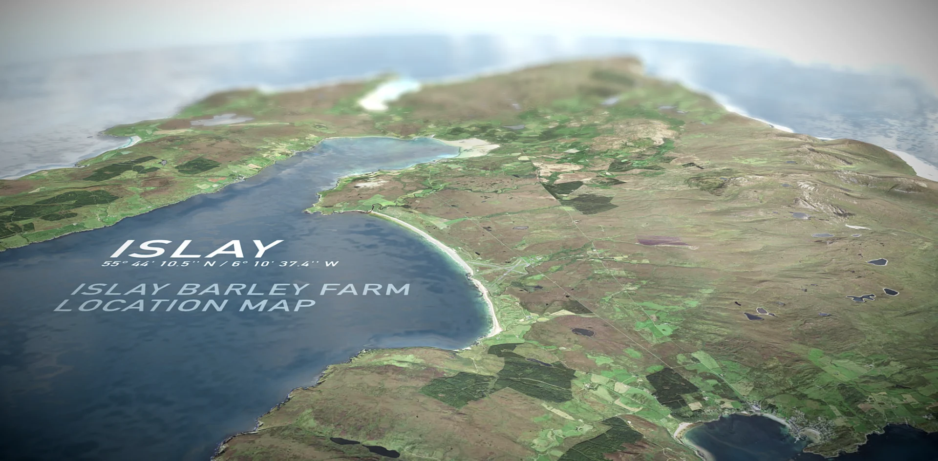
01 / The What
From flat maps to living terrain.
There was no external brief for this. It was a self-initiated evolution of a 2D convention we had used for years: flat maps that illustrated farm names and positions but lost the landscape they sat in. The flat version told you where a farm was; it could not show you what that place was actually like.
The question I set myself was whether a 3D interactive equivalent could do more on a product page without adding meaningful load time or technical overhead. If it could carry the same provenance information and the feel of the terrain, while staying light enough for a commercial PDP, it would earn its place.
02 / The Work
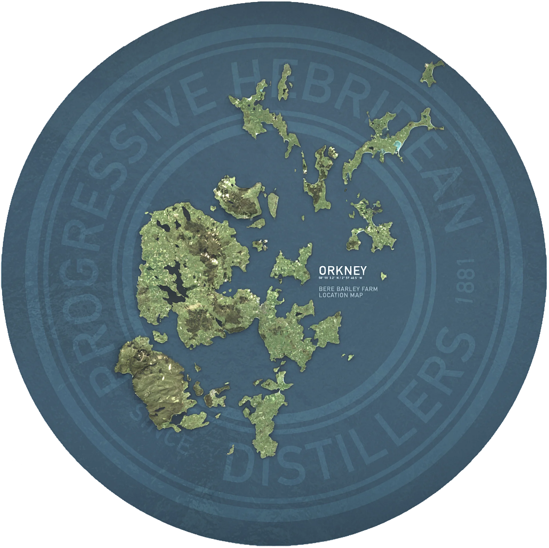
A unique map for every release.
Each map was built as an interactive 3D asset hosted on Sketchfab and embedded into the product pages. Dynamic annotation hotspots identified specific barley farms by name and location, tied to the provenance story of that release.
The maps were not decorative. Each version was configured individually per release with a distinct set of farms, embedding a functional piece of product information rather than a reused visual. At the time of writing, four release iterations were supported across twelve live PDPs.
03 / The Technical Approach
Real terrain, minimal weight.
The core challenge was fidelity versus file size. A high-resolution photographic or rendered landscape at sufficient quality would be prohibitively heavy for a PDP embed. The solution used a four-step pipeline in Cinema 4D.
- Source: 30-metre resolution GIS elevation data, imported via DEM Earth.
- Bake: The elevation data was baked to a height map.
- Displace: The height map was used to displace a low-polygon mesh, producing accurate terrain geometry without a dense vertex count.
- Texture: A high-fidelity satellite texture was applied to the displaced mesh, grounding the 3D surface in recognisable, real-world landscape imagery.
Each finished asset came in at approximately 1MB, well within the threshold for a performant embedded experience. This approach meant the visual quality of actual terrain was retained while keeping the asset suitable for a commercial ecommerce environment.
04 / Outcomes
Built for the release, borrowed for the road.
The maps shipped on PDPs tied to limited-edition releases. When those releases were retired, the PDPs and their maps came down with them. They were designed for specific releases, not as permanent site furniture, and that was the intention.
The telling signal came from outside ecommerce. Brand ambassadors in international markets began incorporating the Sketchfab embeds into their trade presentations without being asked. That lateral adoption, teams in different markets independently reusing them, suggested the maps were communicating something the existing materials weren’t.
05 / What This Connects To
Part of a longer thread.
The provenance maps sit in a longer thread running through the work at the distillery: the question of how new digital tools can communicate craft and origin in ways static design cannot.
The same question is at the centre of the Bruichladdich 3D Bottle Viewer, which used Sketchfab for product presentation rather than geographic storytelling. It carried forward into The Macklowe, where a 3D product experience became the primary vehicle for communicating material and craft at an ultra-premium level.